The Town of Gibsons is developing its first Urban Forest Plan (UFP)
The Town of Gibsons is pleased to announce the launch of its first-ever Urban Forest Plan (UFP), which will assess the current condition of Gibsons’ tree canopy and provide a strategic roadmap to help guide urban forest management for years to come.
The Town of Gibsons’ urban forest is comprised of a mixture of native and non-native trees growing in natural and constructed environments. A healthy urban forest is part of the Town’s approach to climate change adaptation and mitigation. Trees and forest ecosystems regulate air temperature, sequester carbon, and return water to the soil, buffering our community from impacts like high temperatures and heavy rainfall. Furthermore, trees provide direct benefits to human health and well-being and enhance the liveability of neighbourhoods.
The Plan will guide the Town in responding to a wide range of challenges facing the urban forest, such as development, climate change, invasive species, and more. Implementation of the plan will help to grow the Town’s tree canopy and ensure that the environmental, economic, and social benefits that trees provide are protected for years to come.
We want to hear from you!
The survey is now closed.
View the Phase 1 Engagement Summary
View the presentation from the open house
View the PowerPoint Presentation
Project description:
The Plan will be guided by the community’s vision and values, supported by a set of recommendations the Town can implement to achieve the vision. The UFP will include:
· Baseline information on the current state of the Town’s urban forest.
· A long-term vision for the Town’s urban forest, informed by public engagement.
· Goals, recommendations, and targets for reforestation and conservation.
· An implementation plan based on the recommended actions.
Project timeline:
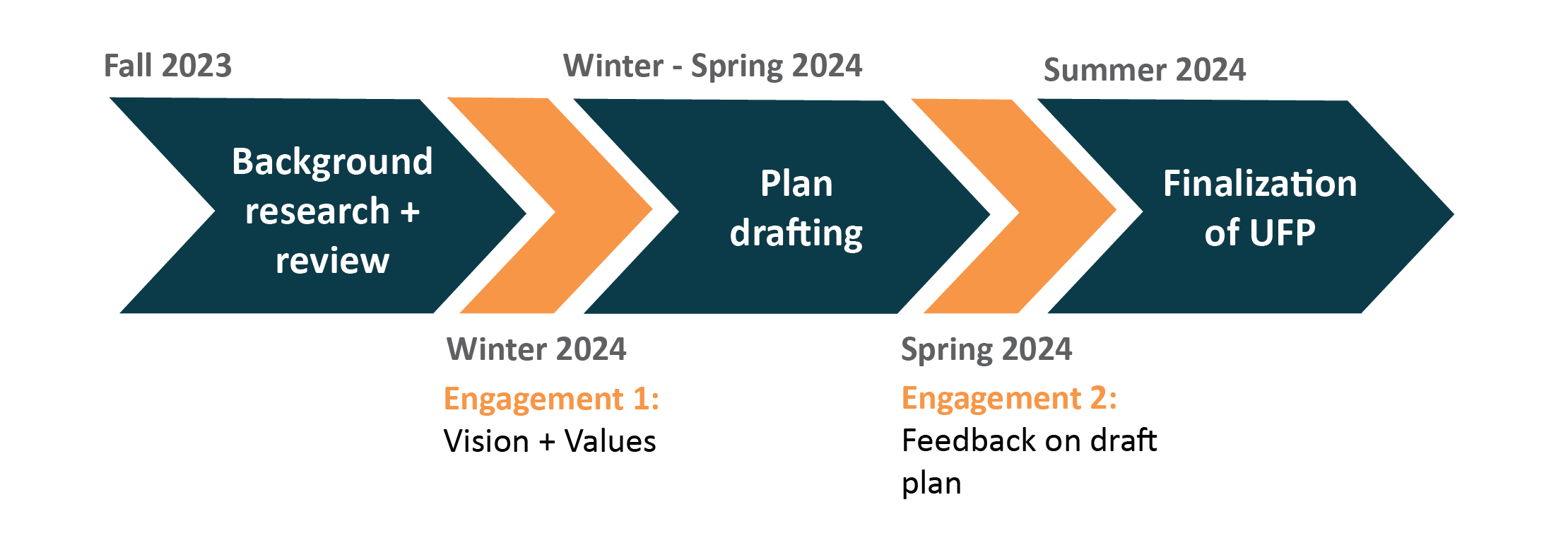
The development of the UFP is occurring over several phases, including two phases of public engagement.
First Phase: Winter 2024
The first phase of public engagement will launch in this winter seeking community input and insights to inform the vision and strategic directions of the draft Urban Forest Plan.
Second Phase: Spring 2024
The second phase, targeted for Spring 2024, will collect feedback on the draft plan.
What is an Urban Forest?
Definition from the Canadian Council of Ministers of the Environment (CCME):
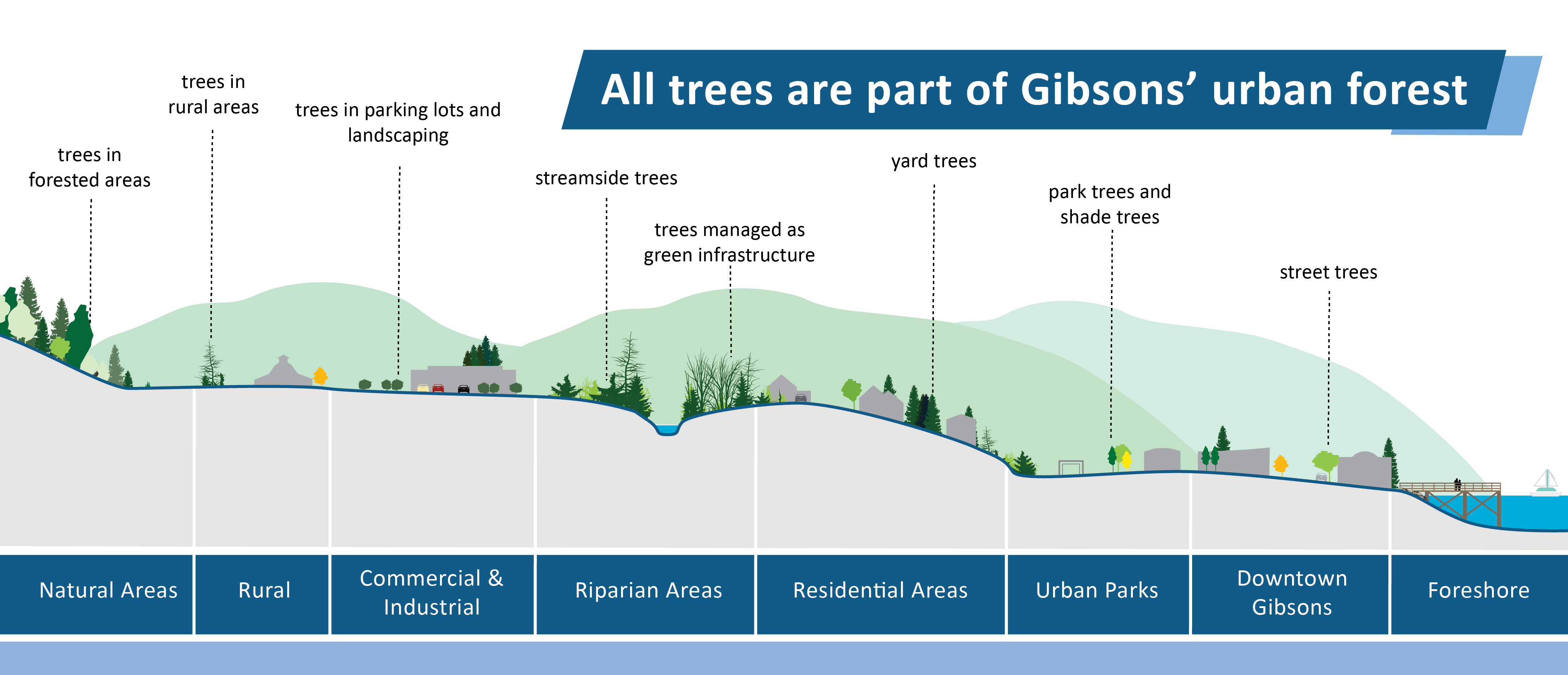
Urban forests are groups of trees with placement along streets and on rooftops, in parks and woodlands within the municipal boundaries of towns and cities, rural communities and on private and public lands. They are ecosystems encompassing shrubs and other greenery, as well as the soil and water that support vegetation.
Urban forests contribute to the health and well-being of residents by providing shade, cleaner air and access to nature. The environmental benefits include helping to mitigate the effects of climate change, stormwater management, erosion control, providing habitat and more.
The benefits of the urban forest include:
Stormwater management
Improved retention of excess precipitation, which is absorbed by leaves, branches and root systems. By reducing runoff, erosion is limited and local soils are stabilized
Water purification
Trees (but also grasses, shrubs, gardens and flowerbeds) provide effective natural water filtration and support the infiltration of cleaner groundwater.
Air quality
Trees help remove pollutants including carbon monoxide, ground level ozone and airborne particulate matter from the air.
Carbon sequestration
Trees remove carbon dioxide from the atmosphere.
Reduced noise pollution
Urban tree coverage helps to buffer excess noise from traffic and construction, which can be difficult to value in monetary terms but likely enhances the quality of life in developed areas.
Human health and well-being
There is evidence that living and working close to trees improves mood, focus and psychological health. In addition, forested spaces promote outdoor recreation, increasing physical activity when suitably designed and managed for those purposes, as well as food security when fruit trees are used.
Habitat and the protection of biodiversity
For wildlife, urban forests represent a critical form of natural habitat to species living in or migrating through urban areas.
The economy and value of property
Because urban forests and trees enhance the aesthetic qualities of Canadian towns and cities, they increase property value


