Services
Aquifer 560
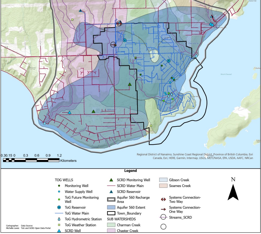
Aquifer 560 is a high-quality confined aquifer that lies beneath the Town of Gibsons and extends into the surrounding Sunshine Coast Regional District (see map below, shown in blue). This underground reservoir stores and delivers clean groundwater to the Town’s wells, providing 100% of Gibsons’ drinking water.
The Town draws water from three wells in Lower Gibsons and one well in Upper Gibsons, all tapping directly into this natural resource.
Watersheds that Feed the Aquifer
The aquifer is naturally recharged by several local watersheds:
- Charman Creek
- Chaster Creek
- Gibson Creek
- Soames Creek
All four creeks originate on the south-facing slope of Mount Elphinstone, above 1,100 metres elevation, and drain into the Salish Sea.
Monitoring and Management
The Town closely monitors Aquifer 560 to ensure a sustainable water supply:
- Water volume is tracked hourly from each well.
- Real-time sensors show the water level at each well location.
- An annual monitoring program tracks trends in water levels, quality, and recharge rates.
- Ongoing data collection helps assess the aquifer’s capacity under various demand and climate scenarios.
Did You Know?
- The aquifer is recognized as a natural asset, delivering municipal services like water storage and filtration, just like engineered infrastructure.
- It’s made of gravel and sand saturated with water, not an underground lake or river.
- Groundwater moves slowly through the aquifer. A drop of rain falling on Mount Elphinstone could take up to 10 years to reach a well in Lower Gibsons.
