Climate Action
Source to Sea Project

Background
Until now, the Town’s natural asset management work has been restricted the Town of Gibsons’ municipal boundaries.
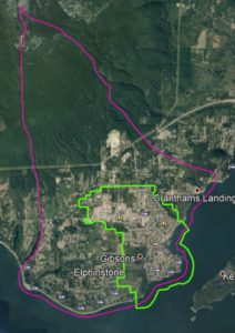
S2S seeks to extend the scope of that work by evaluating the natural assets that lie within the entire watershed of Aquifer 560, which begins at the top of Mount Elphinstone and extends to the sea, and includes sub-catchments for the 4 major creek systems (Chaster, Charman, Gibson and Soames).
This is considered to be a more ecologically relevant scale, as activity that impacts the natural assets within the watershed (but outside of Town boundaries) also impacts our community’s stormwater management, flood mitigation and drinking water services.
Project Goals & Objectives
Specifically, we seek to understand the current and possible future roles of the natural assets in providing:
- safe, reliable drinking water supply through the aquifer recharge;
- stormwater management services; and
- flood mitigation services.
This will be done by:
- establishing a baseline inventory of the natural assets that support water services;
- providing a condition assessment of the identified areas;
- understanding the level of service of the identified natural assets; and
- recommending best management practices of the natural assets identified.
Why does this matter?
Information collected on the Charman Creek Lands and Arrowhead Park through the scope of this project will provide staff and Council with the information required to make informed decisions regarding future uses of the forested areas. These areas provide stormwater functions through both the soils and the trees and are included in the Town’s natural asset inventory.
Data gathered through this project may also be used as inputs for the Aquifer Mapping Study update, and to support implementation of recommendations contained in the Town’s Integrated Stormwater Management Plan.
Project Partners
S2S is being conducted in partnership with the Municipal Natural Assets Initiative, concurrent with its Managing Natural Assets to Coastal Resilience project.
Engagement and input will also be sought from:
- Sunshine Coast Regional District (drainage and watershed governance);
- Ministry of Transportation and Infrastructure (drainage);
- Ministry of Forests, Lands and Natural Resource Operations / BC Timber Sales (aquifer and watershed governance); and
- First Nations (cultural and watershed governance).
This project was supported through the Healthy Watersheds Initiative, which is delivered by the Real Estate Foundation of BC and Watersheds BC, with financial support from the Province of BC as part of its $10-billion COVID-19 response.
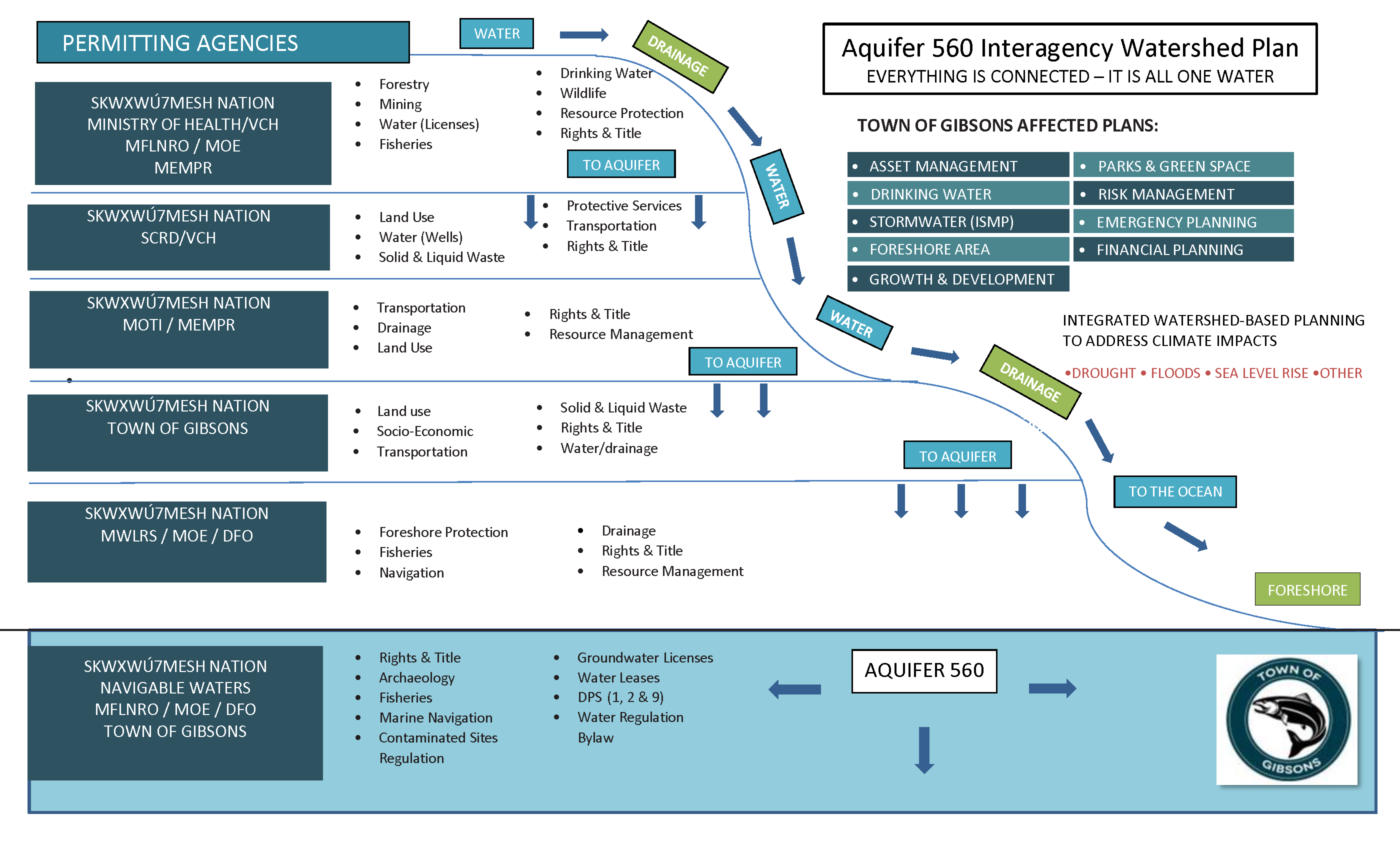
The Interagency Watershed Plan (below) illustrates how managing the aquifer watershed requires effective collaboration across many jurisdictions and organizations.